
AI Photo Editing for Glaciologists — Magic Eraser
How glaciologists use AI photo editing for glacier monitoring, ice-core records, repeat photography, and cryosphere research publications. Enhance ice surface detail, correct extreme high-altitude exposure, and create multi-temporal comparison panels.

Content Lead
Reviewed by Magic Eraser Editorial ·
Table of Contents
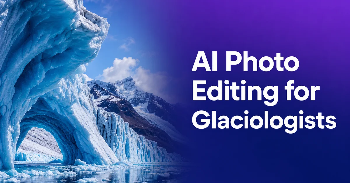
Glaciology — the scientific study of glaciers, ice sheets, ice caps, and their interactions with climate and landscape — depends on photographic records spanning scales from satellite imagery of continental ice sheets to macro photography of individual ice crystals, with time series extending from single field seasons to archival comparisons spanning more than a century. The about 200,000 glaciers cataloged globally in the Randolph Glacier Inventory, plus the Greenland and Antarctic ice sheets, represent a photographic records challenge that grows more urgent as accelerating ice loss makes every season's imagery a record of conditions that may never recur. Repeat photography — returning to the same camera position to photograph the same glacier at intervals — remains one of the most powerful and visually strong methods for documenting glacial change. The resulting image pairs demand careful post-processing to ensure that visible differences reflect actual ice change rather than photographic artifacts.
The photographic challenges in glaciology are shaped by extreme settings and the optical properties of ice itself. High-altitude and polar field sites subject cameras to intense UV radiation that shifts color balance, extreme cold that affects battery performance and can cause condensation on optics, and reflectance from snow and ice surfaces that overwhelms standard metering. Ice is at once transparent, translucent, and opaque depending on its crystal structure and bubble content, creating surfaces that behave optically unlike any common photographic subject. Crevasse interiors are deeply shadowed while surrounding ice surfaces are blindingly bright, often within the same frame. The features that glaciologists need to see — subtle surface texture differences, faint annual layering in ice cores, and the barely visible dirty ice that marks subglacial debris entrainment — exist at the very edge of photographic tonal resolution.
AI photo editing tools address these challenges by automating corrections for the extreme and variable lighting conditions of glacial fieldwork, enhancing the subtle tonal differences that carry scientific information in ice photography, and standardizing images from field campaigns where equipment, weather, and lighting varied unavoidably between sessions. For glaciologists managing fieldwork logistics, laboratory analysis, teaching, grant writing, and the increasing demand for public-facing climate communication at once, efficient post-processing is key for converting raw field photographs into publication-quality scientific imagery and strong public outreach materials that make the reality of glacier change visually undeniable.
- AI enhancement sharpens the subtle tonal differences between ice types — firn, glacial ice, blue dense ice, bubbly white ice, and debris-laden basal ice — that carry critical scientific information.
- Magic Eraser removes field equipment, research personnel, and atmospheric artifacts from glacier photographs intended for publication or public climate communication.
- Color correction normalizes images across extreme high-altitude UV shifts, snow-surface overexposure, and variable polar lighting that characterize glacial field photography.
- Multi-temporal repeat photography pairs are registered and normalized so visible differences reflect actual glacial change rather than photographic variation between sessions.
- Publication-ready figure panels and web-optimized comparison images serve both peer-reviewed research and the public outreach that communicates cryosphere science to broader audiences.
Repeat photography: the photographic backbone of glacier change documentation
Repeat photography — systematically revisiting fixed camera stations to photograph the same glacier view at intervals ranging from seasonal to decadal — has documented glacier change since the earliest days of mountain photography in the mid-nineteenth century. The photographic archives of organizations like the Swiss Glacier Monitoring Network, the U.S. Geological Survey's Repeat Photography Project, and the collections of alpine clubs across Europe contain historical images of glaciers dating back to the 1850s that, when paired with modern photographs from the same vantage points, provide some of the most visually striking and scientifically valuable evidence of climate-driven ice loss. Processing these image pairs for meaningful comparison requires careful attention to registration, cropping, color normalization. The removal of elements that differ between time periods for reasons unrelated to glacier change.
AI post-processing transforms raw repeat photography pairs into scientifically rigorous and visually strong comparisons. Color normalization across decades — compensating for the shift from orthochromatic glass plates through panchromatic film to modern digital sensors — ensures that tonal differences between historical and modern images reflect actual changes in ice extent and surface character rather than differences in photographic technology. Exposure correction addresses the reality that historical and modern photographs were rarely taken under identical lighting conditions. Vegetation changes on deglaciated terrain, new infrastructure. Different snow cover on surrounding mountains can all distract from the glacier change being documented. Magic Eraser removes these non-glacial changes when they would confuse the visual comparison.
The scientific rigor of repeat photography depends on showing that image differences are real. That the glacier has actually retreated, thinned, or changed surface character rather than that the photographs were taken from slightly different positions or under different conditions. AI-assisted registration aligns modern images to historical camera positions with sub-pixel precision, using the permanent landscape features. Bedrock outcrops, moraine crests, mountain ridges — that remain unchanged between time periods as control points. This geometric consistency, combined with color and exposure normalization, produces repeat photography pairs where the visual difference between images can be confidently attributed to actual glacial change, making the resulting comparisons defensible as scientific evidence rather than merely suggestive visual analogies.
- Repeat photography archives extending to the 1850s provide century-plus visual records of glacier change when paired with modern images from the same camera stations.
- Color normalization across photographic technologies — glass plates through digital sensors — ensures tonal differences reflect actual ice changes rather than equipment evolution.
- Magic Eraser removes non-glacial changes (vegetation, infrastructure, variable snow cover) that distract from glacier change in multi-temporal comparison pairs.
- Sub-pixel geometric registration using permanent landscape features makes repeat photography comparisons defensible as quantitative scientific evidence of glacial change.
Ice-core photography and stratigraphic layer documentation
Ice cores extracted from glaciers and ice sheets contain layered records of past climate stretching back hundreds of thousands of years. Photographic records of these cores are key for both scientific analysis and archival preservation. Annual layers in ice cores — visible as alternating clear winter ice and bubbly summer ice — record accumulation rates and seasonal timing. Volcanic ash horizons appear as thin dark bands that provide absolute chronological markers. Dust layers record wind conditions and source-region aridity. Trapped gas bubbles, whose size and distribution change with depth as firn compacts into dense glacial ice, provide information about past atmospheric composition and ice dynamics. All of these features must be photographed clearly and consistently across core sections that may total kilometers in combined length.
AI boost is mainly valuable for ice-core photography because the features of scientific interest often have very low tonal contrast. Annual layers in deep ice where compaction has minimized the density difference between summer and winter accumulation may be barely visible to the naked eye and require careful lighting and boost to photograph clearly. Volcanic ash horizons can be thin enough that they appear as faint gray lines rather than distinct bands. The transition from firn to glacial ice — a critical zone for understanding compaction processes and the age at which trapped air becomes sealed from the atmosphere — involves gradual changes in bubble size and distribution that must be resolved photographically for analysis. Boost brings these low-contrast features to publication visibility without introducing artifacts that could be mistaken for real stratigraphic features.
Standardization is critical because ice-core photography is often performed under challenging conditions. In cold-room laboratories maintained at minus twenty degrees Celsius or colder, cameras, lighting, and photographers all perform suboptimally. Different core-processing campaigns may use different lighting setups, camera systems, and handling protocols, yet the resulting images must be comparable across the entire core length for consistent stratigraphic interpretation. AI batch processing normalizes lighting, color balance, and exposure across hundreds of core-section photographs, producing the visual consistency needed for steady stratigraphic analysis from surface to bedrock while keeping the authentic tonal variations that carry paleoclimatic information.
- Annual ice layers, volcanic ash horizons, dust bands, and gas bubble distributions are all photographically documented features essential for paleoclimate reconstruction.
- Enhancement recovers extremely low-contrast stratigraphic features — faint annual layers and thin ash horizons — without introducing artifacts that could mimic real features.
- Cold-room photography at minus twenty degrees produces variable image quality that AI batch processing normalizes across hundreds of core sections for consistent analysis.
- Standardization preserves authentic tonal variations carrying paleoclimatic data while correcting the lighting and equipment inconsistencies inherent to cold-laboratory conditions.
Glacial geomorphology and landscape change documentation
Beyond the glaciers themselves, glaciologists document the landscape features that glaciers create, modify, and leave behind as they advance and retreat. Moraines, drumlins, eskers, kettle lakes, glacial erratics, striated bedrock, meltwater channels, and the full suite of depositional and erosional landforms that record past glacial activity. Photographing these features for scientific records and teaching requires clear visibility of surface textures, sediment traits. Spatial relationships that reveal the direction, intensity, and duration of past ice flow. Many glacial landforms are subtle — low-relief ground moraines, faint striations on bedrock surfaces. Barely visible trimlines that mark the maximum height of past ice surfaces — and benefit greatly from AI boost that increases the visibility of surface texture and tonal variation.
Aerial and drone photography has transformed glacial geomorphology by providing the overhead perspective needed to see landform patterns that are invisible from ground level. Drumlin fields, esker networks, and moraine sequences reveal their organized patterns only from above, and the availability of consumer drones has made aerial glacial geomorphology accessible to individual researchers and small field teams. AI processing of drone imagery corrects the lens distortion, uneven exposure. Color variation that occur across multi-image survey flights, and removes the shadows that obscure surface details in images taken during the low-angle sun conditions typical of high-latitude glaciated landscapes.
Historical landscape photography gains particular scientific value when AI processing enables precise comparison with modern views. Valley-floor photographs taken during the Little Ice Age maximum or early retreat phase show ice-covered or freshly deglaciated terrain that has since been transformed by decades of soil development, vegetation colonization, and human change. Processing these historical images to maximize the visibility of glacial features. Moraine positions, ice surface height indicators, glacial lake extent, and outwash fan morphology — and then presenting them alongside identically framed modern photographs creates powerful visual records of both glacial retreat and the secondary landscape changes that follow deglaciation.
- Subtle glacial landforms — low-relief moraines, faint bedrock striations, and barely visible trimlines — benefit from AI enhancement of surface texture and tonal variation.
- Drone imagery of drumlin fields, esker networks, and moraine sequences requires AI correction of lens distortion, exposure variation, and low-angle shadows across survey flights.
- Historical landscape photographs processed for maximum glacial-feature visibility create powerful comparisons with modern views documenting both retreat and post-glacial landscape change.
- Aerial perspective reveals organized landform patterns invisible from ground level, making drone-acquired and AI-processed imagery essential for modern glacial geomorphology.
Public outreach and climate communication through glacier imagery
Glacier imagery occupies a unique position in climate communication because glacier change is visually dramatic, immediately comprehensible to non-specialist audiences, and directly observable in photographs without requiring statistical interpretation. A repeat photography pair showing a glacier's terminus retreating hundreds of meters upvalley over decades communicates climate change with an immediacy and emotional impact that temperature graphs and statistical trends cannot match. For this reason, glaciologists are increasingly called upon to provide high-quality processed imagery for media, education, museum exhibitions, government reports, and public awareness campaigns. Applications where image quality and visual clarity directly affect the persuasiveness and accessibility of the climate science being communicated.
AI processing transforms raw field photographs into outreach-quality imagery that meets the visual standards of expert publications and exhibitions while maintaining scientific accuracy. The challenge is that authentic field photography, taken under the harsh, variable conditions of actual glacier research, rarely meets the aesthetic standards that public audiences expect from expert imagery. Flat overcast lighting, equipment in the frame, unflattering angles dictated by terrain access rather than composition, and the general visual chaos of an active field site all work against producing naturally publication-ready images. AI post-processing addresses these limitations while keeping the documentary realism that distinguishes real research imagery from stock photography or artistic renderings.
Educational applications require particular attention to clarity and annotation. Glacier photographs used in university courses, textbooks, and museum exhibits need to clearly show the features being discussed — equilibrium line position, crevasse field patterns, medial moraine formation, calving face geometry, and the distinction between clean and debris-covered ice. AI boost makes these features visually distinct for students and public audiences who lack the trained eye that glaciologists develop through years of field observation. Combined with thoughtful annotation and comparison layouts, AI-processed glacier imagery becomes a powerful teaching tool that bridges the gap between specialist knowledge and public understanding of how glaciers work, why they are changing, and what that change means.
- Repeat photography pairs showing glacier retreat communicate climate change with visual immediacy that temperature graphs and statistical trends cannot match.
- AI transforms raw field photographs into outreach-quality images meeting professional publication standards while preserving the documentary authenticity of real research imagery.
- Educational applications demand feature clarity for non-specialist audiences who lack the trained observation skills glaciologists develop through years of fieldwork.
- Processed glacier imagery bridges specialist knowledge and public understanding for media, museum exhibitions, government reports, and awareness campaigns.
How to do it
- 1
Photograph glacial features with standardized field protocols for scientific consistency
Establish fixed camera stations at marked GPS coordinates for repeat photography series that document glacier change over seasons, years, and decades. Include permanent landscape reference points — bedrock outcrops, nunataks, moraines. Survey markers — in every frame to enable accurate spatial registration between images taken at different times. Use consistent focal length, exposure settings documented in a field notebook. A color calibration card visible in at least one frame per session. For close-range records of ice features like crevasse patterns, ogives, moulins, and moraines, include a scale reference and compass orientation.
- 2
Remove fieldwork equipment, personnel, and atmospheric interference from scientific images
Use Magic Eraser to remove field equipment (tents, instruments, helicopter landing markers, safety ropes), research personnel. Temporary installations that appear in glacier photographs intended for publication or public-facing communication. Background Eraser isolates specific glacial features. Individual crevasses, moulin openings, supraglacial streams, and ice-core sections — from the surrounding ice and rock for detailed analysis imagery. For aerial and satellite-derived photographs, remove cloud shadows, aircraft wing intrusions. Sensor artifacts that obscure the ice surface features being documented.
- 3
Enhance ice surface detail, structural features, and stratigraphic layers
Use AI Enhance to sharpen the subtle textural and tonal differences that distinguish glacier ice types. Firn from glacial ice, blue dense ice from bubbly white ice, debris-laden basal ice from clean accumulation-zone ice. Boost is mainly valuable for ice-core photography where annual layer boundaries, volcanic ash horizons. Trapped gas bubble distributions must be clearly visible for publication. For crevasse field records, boost brings out the internal structure of crevasse walls where crystal fabric and trapped debris reveal ice flow history.
- 4
Correct color and exposure across variable high-altitude lighting conditions
Glacial settings present extreme photographic challenges. Intense UV at high altitude shifts color balance toward blue, snow and ice reflectance causes severe overexposure, flat overcast light eliminates the surface texture that reveals ice morphology, and low-angle polar light creates extreme contrast between sunlit and shadowed surfaces. AI color correction normalizes images from field campaigns spanning different weather conditions, seasons. Times of day, producing consistent visual records where ice surface features are clearly visible regardless of the lighting conditions during capture.
- 5
Prepare multi-temporal comparison plates and publication-ready figure panels
Arrange repeat photographs from the same camera station across multiple time periods into aligned comparison panels that clearly show glacier retreat, thinning, or advance. Crop, register, and normalize the images so that differences between time periods reflect actual glacial change rather than photographic variation. Export at 300 DPI for journal publication and prepare extra web-optimized versions for public outreach and educational materials where glacier change visualization shares climate science to non-specialist audiences with immediate visual impact.
Sources
- Repeat Photography for Documenting Glacier Change: Methods, Best Practices, and Datasets — Journal of Glaciology — International Glaciological Society
- Global Land Ice Measurements from Space (GLIMS): Remote Sensing and GIS Investigations — GLIMS / National Snow and Ice Data Center
- Photogrammetric Methods for Glacier Monitoring: From Historical Archives to UAV Surveys — Frontiers in Earth Science — Frontiers Media