
Edição de fotos com IA para paleoclimatologistas — Magic Eraser
Como paleoclimatologistas usam a edição de fotos com IA para registros de testemunhos de gelo, estratigrafia de testemunhos de sedimento, fotografia de anéis de árvores e análise de proxies climáticos. Aprimore camadas anuais, remova artefatos e crie figuras compostas prontas para publicação.

SEO & Growth
Revisado por Magic Eraser Editorial ·
Índice
- Fotografia de testemunhos de gelo: camadas anuais, horizontes de tefra e estrutura cristalina
- Cor de testemunhos de sedimento como proxy climático: por que a consistência fotográfica importa
- Fotografia dendrocronológica e precisão de medição de largura de anéis
- Documentação de arquivos de espeleotemas, corais e multiproxy
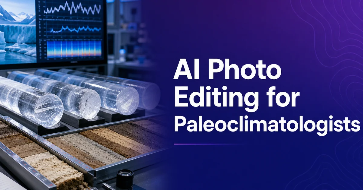
A paleoclimatologia — o estudo da história climática da Terra por meio dos arquivos naturais preservados em testemunhos de gelo, sedimentos oceânicos e lacustres, anéis de árvores, depósitos de cavernas. Os esqueletos de coral — depende, em sua essência, dos registros visuais de amostras físicas. Cada grande indicador paleoclimático carrega sua informação climática em estruturas visíveis: as camadas anuais nos testemunhos de gelo registram ano a ano a queda de neve e a composição atmosférica, os testemunhos de sedimento laminados preservam séculos de produtividade biológica e deposição mineral. Os anéis de árvores codificam a temperatura e a precipitação da estação de crescimento em sua largura e densidade. Fotografar essas estruturas com qualidade e consistência suficientes para medição, publicação e arquivamento é um desafio prático persistente que afeta diretamente a exatidão e a reprodutibilidade das reconstruções paleoclimáticas.
As exigências fotográficas da paleoclimatologia são incomumente rigorosas porque as imagens muitas vezes servem como dados analíticos primários, e não como meras ilustrações. As larguras dos anéis são rotineiramente medidas a partir de fotografias digitais usando software especializado. Os perfis de cor dos testemunhos de sedimento — extraídos pixel a pixel de fotografias de testemunhos padronizadas — servem como registros indicadores climáticos estáveis ao lado das medições geoquímicas. A contagem das camadas anuais dos testemunhos de gelo, que ancora as cronologias que sustentam as reconstruções climáticas globais, é realizada a partir de fotografias de luz transmitida de alta resolução. Em cada caso, a exatidão da reconstrução climática depende da qualidade, da consistência e da padronização das fotografias das quais as medições são extraídas.
As ferramentas de edição de fotos com IA atendem às necessidades específicas de pós-processamento que os paleoclimatologistas enfrentam nesses diversos tipos de indicadores. Boost aguça as estruturas finas — camadas anuais, limites de anéis, contatos de laminações — que carregam a informação climática. A remoção de fundo e de artefatos elimina os equipamentos de laboratório, os danos de preparação e os efeitos de armazenamento que ocultam as características indicadoras. A normalização de cor garante que o registro fotográfico mantenha consistência analítica ao longo das semanas ou meses necessários para imagear um indicador completo. Para um campo em que um único testemunho de gelo ou sequência sedimentar pode representar décadas de investimento de campo, o processamento de imagens eficiente e preciso é um imperativo prático.
- O aprimoramento por IA aguça as estruturas indicadoras críticas para o clima — camadas anuais dos testemunhos de gelo, laminações sedimentares e limites de anéis — que servem como dados analíticos primários.
- A remoção de fundo e de artefatos isola as características indicadoras dos tubos de testemunho, do equipamento de montagem, dos danos de preparação e da degradação de armazenamento sem alterar o detalhe relevante para a medição.
- A normalização de cor ao longo de campanhas de imageamento de múltiplas sessões mantém a consistência fotográfica exigida quando a própria cor do testemunho serve como indicador climático quantitativo.
- O processamento em lote padroniza fotografias de indicadores de diferentes laboratórios, estações de campo e condições de iluminação em registros visuais coerentes que abrangem milhares de anos.
- Os compostos prontos para publicação unem fotografias de seções individuais em figuras contínuas de todo o comprimento do testemunho, em resolução suficiente tanto para revistas impressas quanto para exame digital.
Fotografia de testemunhos de gelo: camadas anuais, horizontes de tefra e estrutura cristalina
A fotografia de testemunhos de gelo apresenta condições singularmente exigentes. O trabalho deve ser realizado em câmaras frias mantidas entre menos vinte e menos trinta graus Celsius, onde tanto o fotógrafo quanto o equipamento operam com eficiência reduzida. Os testemunhos de gelo são frequentemente fotografados com luz transmitida para revelar o estratificação anual, com a seção do testemunho colocada sobre uma mesa de luz e iluminada por baixo enquanto uma câmera registra a transparência variável das sucessivas camadas anuais. As camadas de verão tendem a ser mais transparentes (gelo de grão mais grosso com menos bolhas), enquanto as camadas de inverno são mais opacas (gelo de grão fino com alta densidade de bolhas), produzindo uma estratigrafia visual que permite identificar e contar os anos individuais. O contraste entre essas camadas pode ser sutil, principalmente no gelo profundo onde o metamorfismo cristalino homogeneizou parcialmente o estratificação.
O boost por IA melhora enormemente a visibilidade do estratificação anual nas fotografias de testemunhos de gelo, principalmente nas faixas de profundidade críticas em que a contagem de camadas se torna ambígua. Ao aumentar o contraste local dentro da estreita faixa tonal que separa o gelo de verão do de inverno, o boost torna contáveis camadas que de outro modo exigiriam interpretação subjetiva. Essa melhoria da objetividade tem implicações diretas para a exatidão da cronologia dos testemunhos de gelo. A datação de eventos vulcânicos, variações de gases de efeito estufa e transições climáticas abruptas no registro paleoclimático depende toda de uma contagem precisa das camadas anuais. Para os grandes testemunhos da Groenlândia e da Antártida que ancoram as histórias climáticas globais, até pequenas melhorias na visibilidade das camadas em profundidades ambíguas reduzem a incerteza de datação ao longo de todo o registro.
As camadas de tefra vulcânica — finos horizontes de cinza vulcânica preservados no gelo — servem como pontos de ancoragem cronológica críticos que conectam os registros dos testemunhos de gelo entre si e a erupções vulcânicas datadas de forma independente. Essas camadas podem ter apenas uma fração de milímetro de espessura e aparecer como tênues linhas escuras nas fotografias de luz transmitida. O boost por IA faz emergir esses horizontes sutis aumentando o contraste entre as finas partículas vulcânicas e a matriz de gelo circundante. Magic Eraser remove os artefatos de preparação que frequentemente ocultam as camadas de tefra. Arranhões da lâmina do micrótomo usada para preparar a superfície plana do gelo, cristais de geada que se formam na superfície fria durante a fotografia, e partículas de poeira que se depositam do ar da câmara fria.
- A fotografia em câmara fria entre menos vinte e menos trinta graus desafia tanto o equipamento quanto os operadores, tornando o pós-processamento eficiente essencial para as campanhas de imageamento de testemunhos de gelo.
- O aprimoramento por IA aumenta a visibilidade das camadas anuais nas zonas críticas de gelo profundo onde os sutis contrastes de transparência verão-inverno se tornam ambíguos para a contagem manual.
- Os horizontes de tefra vulcânica — pontos de ancoragem cronológica críticos por vezes com apenas frações de milímetro de espessura — tornam-se identificáveis quando a IA aumenta o contraste entre as partículas de cinza e a matriz de gelo.
- Magic Eraser remove os arranhões do micrótomo, os cristais de geada e a poeira da câmara fria que ocultam o estratificação anual e os horizontes de tefra sem alterar a estrutura do gelo relevante para o indicador.
Cor de testemunhos de sedimento como proxy climático: por que a consistência fotográfica importa
Na paleoclimatologia marinha e lacustre, a cor de um testemunho de sedimento é, ela própria, um indicador climático primário. A vermelhidão do sedimento (medida como o parâmetro a* no espaço de cor CIE Lab) correlaciona-se com a abundância de minerais de óxido de ferro que indicam aporte sedimentar terrígeno do intemperismo continental. A luminosidade do sedimento (L*) correlaciona-se com o teor de carbonato nos testemunhos marinhos e com o teor de carbono orgânico nos testemunhos lacustres, ambos respondendo à produtividade biológica impulsionada pelas condições climáticas. Esses parâmetros de cor são rotineiramente extraídos de fotografias digitais de superfícies de testemunho seccionadas usando varredura automatizada ou software de análise de imagem, tornando o registro fotográfico um conjunto de dados analítico quantitativo em vez de uma ilustração qualitativa.
O uso analítico das fotografias de testemunhos impõe exigências rigorosas de consistência fotográfica que vão além dos padrões habituais de imageamento científico. Se o balanço de branco, a exposição ou a geometria de iluminação variarem entre as sessões. Mesmo de forma sutil — o registro indicador de cor extraído conterá saltos e tendências artificiais indistinguíveis dos sinais climáticos reais. Um testemunho de sedimento de uma expedição de perfuração em águas profundas pode compreender centenas de seções individuais fotografadas ao longo de dias ou semanas à medida que o testemunho é processado. Cada seção deve ser fotografada sob condições idênticas ou corrigida para padrões idênticos. A normalização de cor por IA, calibrada em relação aos alvos de referência de cor incluídos em cada fotografia, compensa a inevitável deriva das condições de iluminação, da resposta do sensor da câmera e da uniformidade da mesa de luz ao longo de campanhas de imageamento prolongadas.
Além da consistência de cor, a fotografia de testemunhos de sedimento deve resolver com exatidão as laminações físicas que representam eventos deposicionais individuais. Camadas de tempestade, ciclos de produtividade sazonal, quedas de cinza vulcânica ou depósitos de correntes de turbidez. No sedimento varvado (laminado anualmente), cada par de lâminas claras e escuras representa um ano. Sua espessura codifica a intensidade da deposição sedimentar daquele ano. Contar e medir essas lâminas a partir de fotografias exige imageamento nítido e de alto contraste de limites que podem estar a menos de um milímetro de distância. O boost por IA aumenta o contraste nos limites das laminações sem introduzir bordas artificiais, tornando a contagem e a medição automatizadas das laminações a partir de fotografias mais confiáveis e menos dependentes da interpretação humana subjetiva.
- Os parâmetros de cor do sedimento (L*, a*, b*) extraídos das fotografias de testemunhos servem como indicadores climáticos quantitativos correlacionados com o teor de carbonato, os minerais de óxido de ferro e o carbono orgânico.
- A consistência fotográfica ao longo de centenas de seções de testemunho é analiticamente crítica — a deriva da iluminação produz sinais artificiais indistinguíveis das variações climáticas reais nos registros indicadores de cor.
- A normalização de cor por IA calibrada em relação a alvos de referência compensa a inevitável deriva do equipamento ao longo de dias ou semanas de fotografia de testemunhos.
- O aprimoramento dos limites de laminação torna a contagem automatizada de varvas mais confiável sem introduzir bordas artificiais que poderiam enviesar as medições de espessura.
Fotografia dendrocronológica e precisão de medição de largura de anéis
A fotografia de anéis de árvores para a pesquisa paleoclimática exige imageamento nítido e de alto contraste do limite entre o lenho inicial (as células largas, de paredes finas, produzidas durante o crescimento da primavera) e o lenho tardio (as células estreitas, de paredes espessas, produzidas no fim do verão). A medição da largura do anel que constitui a base da reconstrução dendroclimatológica é a distância de um limite lenho inicial–lenho tardio ao próximo. A exatidão da medição depende diretamente de quão claramente esse limite é resolvido na fotografia. Em espécies de coníferas com limites de anel nítidos, o contraste costuma ser adequado, mas em muitas espécies folhosas. Principalmente em árvores tropicais onde os limites de anel podem estar ausentes ou ser muito sutis — até pequenas melhorias na visibilidade do limite afetam enormemente a precisão da medição.
O software de medição de largura de anéis opera sobre fotografias digitais detectando a transição do claro para o escuro nos limites dos anéis. Imagens com iluminação inconsistente, reflexo de superfície devido a resíduos de pasta de polimento, ou foco irregular ao longo da amostra produzem erros de medição quando o algoritmo do software identifica erroneamente gradientes de brilho como limites de anel ou deixa de detectar limites genuínos que caem abaixo do limiar de contraste. O boost por IA pré-processa as fotografias para equalizar a iluminação, reduzir os artefatos de reflexo. Aguçar o padrão específico de transição claro-escuro que corresponde aos limites anatômicos dos anéis, melhorando a relação sinal-ruído para os algoritmos de medição automatizados.
A datação cruzada — o processo de combinar padrões de largura de anéis entre espécimes sobrepostos para construir uma cronologia estável que se estende além do tempo de vida de uma única árvore — exige a comparação de padrões de anéis ao longo de várias amostras que podem ter sido fotografadas em diferentes ampliações, sob diferentes iluminações e com diferentes câmeras. A normalização em lote por IA padroniza essas fotografias para permitir uma combinação visual confiável de padrões. Permanece um complemento essencial aos métodos estatísticos de datação cruzada. Para os principais eventos climáticos visíveis no registro dos anéis. Anéis de geada de grandes erupções vulcânicas, sequências de anéis estreitos de secas plurianuais, lenho de reação de tempestades catastróficas — as fotografias padronizadas servem ao mesmo tempo como dados analíticos e como potentes registros visuais nas publicações.
- A definição do limite lenho inicial–lenho tardio determina diretamente a exatidão da medição da largura do anel, especialmente em espécies folhosas onde o contraste do anel é inerentemente sutil.
- O pré-processamento por IA equaliza a iluminação e reduz os reflexos de superfície, melhorando a relação sinal-ruído para os algoritmos automatizados de detecção de limites de anel usados no software de medição.
- A datação cruzada entre espécimes sobrepostos exige consistência visual entre fotografias tiradas em diferentes ampliações, condições de iluminação e laboratórios.
- A fotografia padronizada das assinaturas de eventos climáticos — anéis de geada, sequências de seca, lenho de reação de tempestade — serve tanto a fins analíticos quanto de comunicação visual nas publicações.
Documentação de arquivos de espeleotemas, corais e multiproxy
Os espeleotemas — depósitos minerais de cavernas incluindo estalagmites, estalactites. O fluxostone — registram a história climática em suas laminações de crescimento, com cada camada refletindo a química da água de gotejamento e as condições da caverna no momento da deposição. Fotografar seções transversais polidas de espeleotemas exige iluminação controlada que revele as finas laminações formadas pela alternância da mineralogia calcita-aragonita, pelas variações do teor orgânico e pelas mudanças na trama cristalina. Essas laminações podem ser de escala submilimétrica, e sua visibilidade depende fortemente do ângulo de iluminação. A iluminação oblíqua realça o contraste topográfico entre as camadas mais duras e mais moles da superfície polida. O boost por IA aguça esses limites de laminação para contagem e medição, enquanto a correção de cor compensa a dominante quente que as montagens de iluminação oblíqua de tungstênio frequentemente introduzem.
A paleoclimatologia de corais usa o bandeamento de densidade anual visível em radiografias de raios X e seções delgadas do esqueleto de coral para reconstruir a temperatura da superfície do mar e outras variáveis ambientais. O contraste de densidade entre as bandas de alta e baixa densidade nas radiografias de raios X de coral pode ser sutil. Um boost que aumenta esse contraste sem introduzir artefatos de ruído melhora diretamente a exatidão da contagem de bandas e das medições de densitometria. Para as seções delgadas de coral fotografadas sob luz polarizada. A trama cristalográfica codifica informação ambiental, as ferramentas de IA podem aguçar os padrões de polarização que indicam a orientação e o tamanho dos cristais sem alterar as propriedades ópticas que carregam o sinal analítico.
A pesquisa paleoclimática moderna combina cada vez mais múltiplos tipos de indicadores para construir reconstruções climáticas completas. Os registros fotográficos devem sustentar essa abordagem multi-indicador. Um único estudo pode apresentar a estratigrafia de um testemunho de gelo, as laminações de um testemunho de sedimento, sequências de anéis de árvores. Seções de espeleotema como evidência concordante de um evento climático. O processamento em lote por IA normaliza a exibição visual dessas diversas fotografias de indicadores. Equalizar a exposição, aguçar o detalhe do indicador e remover artefatos — para que a figura composta apresente um registro multi-indicador visualmente coerente em que o sinal climático se destaque de modo uniforme em todos os tipos de indicador em vez de ser ocultado pelas inconsistências fotográficas entre as diferentes montagens de imageamento.
- A fotografia de laminações de espeleotemas sob iluminação oblíqua revela a alternância calcita-aragonita — o aprimoramento por IA aguça os limites submilimétricos enquanto corrige os artefatos de iluminação de dominante quente.
- O bandeamento de densidade das radiografias de raios X de coral beneficia-se de um aprimoramento de contraste que aumenta a exatidão da contagem de bandas e da medição densitométrica sem introduzir ruído.
- A fotografia em seção delgada sob luz polarizada da trama cristalográfica do coral preserva as propriedades ópticas analiticamente críticas enquanto aguça os padrões de orientação e tamanho dos cristais.
- A preparação de figuras multi-indicador usa a normalização em lote por IA para apresentar registros compostos visualmente coerentes em que os sinais climáticos se leem de modo uniforme em diversos tipos de indicador e montagens de imageamento.
How to do it
- 1
Photograph climate proxy samples with standardized lighting and scale references
Set up a photography station with controlled, even illumination appropriate to the proxy type being documented. Ice cores require cold-room photography with transmitted and reflected light options to reveal annual layering and bubble structure. Sediment cores need consistent overhead lighting with a color reference card and steady millimeter scale along the core length. Tree ring samples require oblique reflected light to enhance the contrast between earlywood and latewood boundaries. Include a color calibration target in every session to enable accurate white balance correction across multi-day imaging campaigns.
- 2
Remove visual distractions and isolate proxy features for analysis
Use Background Eraser and Magic Eraser to isolate the climate-relevant features from their photographic context. Remove core tube edges, sample mounting hardware, storage tray labels, and laboratory bench surfaces that clutter images intended for publication or measurement. For sediment cores, eliminate cracks from core splitting, surface oxidation artifacts that developed between splitting and photography, and smeared sediment at core margins. For tree ring sections, remove mounting resin blobs, saw marks at section edges, and fungal staining that obscures ring boundaries.
- 3
Enhance proxy detail critical for paleoclimate interpretation
Use AI Enhance to sharpen the fine structures that carry climate information. In ice cores, enhance the visibility of annual dust layers, volcanic tephra horizons, and the boundary between glacial-period ice (small crystals, high dust) and interglacial ice (large crystals, low dust). In sediment cores, enhance lamination visibility, microfossil distribution patterns, and color variations that reflect changes in biological productivity, terrigenous input, or redox conditions. In tree rings, sharpen the earlywood-latewood boundary definition that determines ring-width measurement accuracy.
- 4
Standardize color and exposure across long proxy records
Use batch color correction to normalize photographs taken across multiple sessions, laboratories, or years into a consistent visual record. Paleoclimate proxy records may span thousands of years of material photographed over weeks or months under time-varying conditions. Sediment core color is itself a climate proxy. Variations in gray value, redness, and brightness correlate with organic content, mineral composition, and oxidation state — so photographic consistency across the full core length is analytically critical, not merely cosmetic.
- 5
Prepare composite images and publication-ready figures
Assemble standardized proxy photographs into composite figures showing the full extent of the climate record. For sediment cores, stitch individual section photographs into steady core-length composites with consistent scale. For tree ring chronologies, arrange cross-dated ring sequences to illustrate key climate events. Examples include frost rings from volcanic eruptions, narrow rings from droughts, and reaction wood from storm damage. Export at resolution sufficient for both journal publication (300 DPI minimum) and digital zooming for online added materials where reviewers examine fine proxy detail.
Fontes
- Ice Core Methods: Photographic Documentation Standards for Stratigraphic Analysis — Climate of the Past — Copernicus Publications
- Tree Ring Image Analysis and Standardized Dendrochronological Photography — Laboratory of Tree-Ring Research — University of Arizona
- Best Practices for Sediment Core Photography and Visual Stratigraphy — Quaternary Science Reviews — Elsevier